What This Place Is
Mt. Mito is the highest mountain in the Okutama Sanzan range, situated within a Tokyo citizen's forest (a publicly managed recreational area) in Okutama-machi, Nishitama Gun, approximately 90 minutes west of central Tokyo. The mountain is a moderate-difficulty hiking destination popular with local trekkers and accessible to beginner hikers with reasonable fitness.
What Visitors Consistently Report
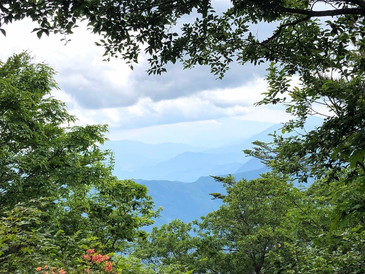
Hikers praise the well-maintained trail system and the relatively quiet, uncrowded experience compared to more famous Tokyo-area peaks. On clear days, visitors report excellent views of Mt. Fuji from the summit. The hike is described as moderately challenging, with steep sections concentrated at the start of the trail, making it manageable for beginners but requiring some physical conditioning. Several visitors note that the forest is peaceful and well-kept, enhancing the overall experience.
Common concerns include minimal trail signage, which can make navigation difficult for those unfamiliar with Japanese mountain markers. Some hikers report feeling uncertain about which route to take at junctions, particularly regarding the choice between ascending via Shekou Pass or passing Sanzu Great Falls first.
Practical Advice for Visitors
Plan for a full 6-hour round-trip hike, including breaks. Start early in the morning (ideally by 7-8 AM) to complete the descent before dark and to maximize your chances of clear weather for Mt. Fuji views. Bring adequate water (at least 2 liters), snacks, and a detailed map or GPS app, as signage is sparse. Wear sturdy hiking boots with good ankle support due to steep early sections. The Shekou Pass route appears to be a popular starting point based on visitor mentions. Dress in layers, as weather can change rapidly at elevation. A headlamp or flashlight is recommended as a safety precaution. The hike is best undertaken on clear days when visibility is good; avoid hiking during or immediately after rain, as steep sections become slippery.
Getting There
Mt. Mito is located in Okutama-machi, approximately 90 minutes from central Tokyo by public transport. Take the JR Chuo Line from Shinjuku Station westbound toward Otsuki, then transfer to the JR Ome Line toward Okutama. Alight at Okutama Station (the final stop on the Ome Line). From Okutama Station, local buses or a taxi can take you to the trailhead near Shekou Pass or other access points; confirm the exact location with your accommodation or a local tourism office, as multiple entry points exist. Driving is an alternative if you have access to a rental car; parking is available near the trailhead, though spaces may be limited on weekends. The journey from Tokyo Station to Okutama Station takes approximately 2-2.5 hours by train.
Common Complaints and Mitigation
The primary complaint is inadequate trail signage, which can lead to confusion at junctions. To mitigate this, download offline maps of the area before departing (Google Maps or Japanese hiking apps like Yamap work well), take a photo of a detailed trail map at the trailhead, and consider hiking with a local guide if you are uncomfortable with navigation. Some visitors also mention the steep initial sections; these are unavoidable but manageable with proper footwear and a steady pace. Arriving early helps avoid the stress of descending in poor light.