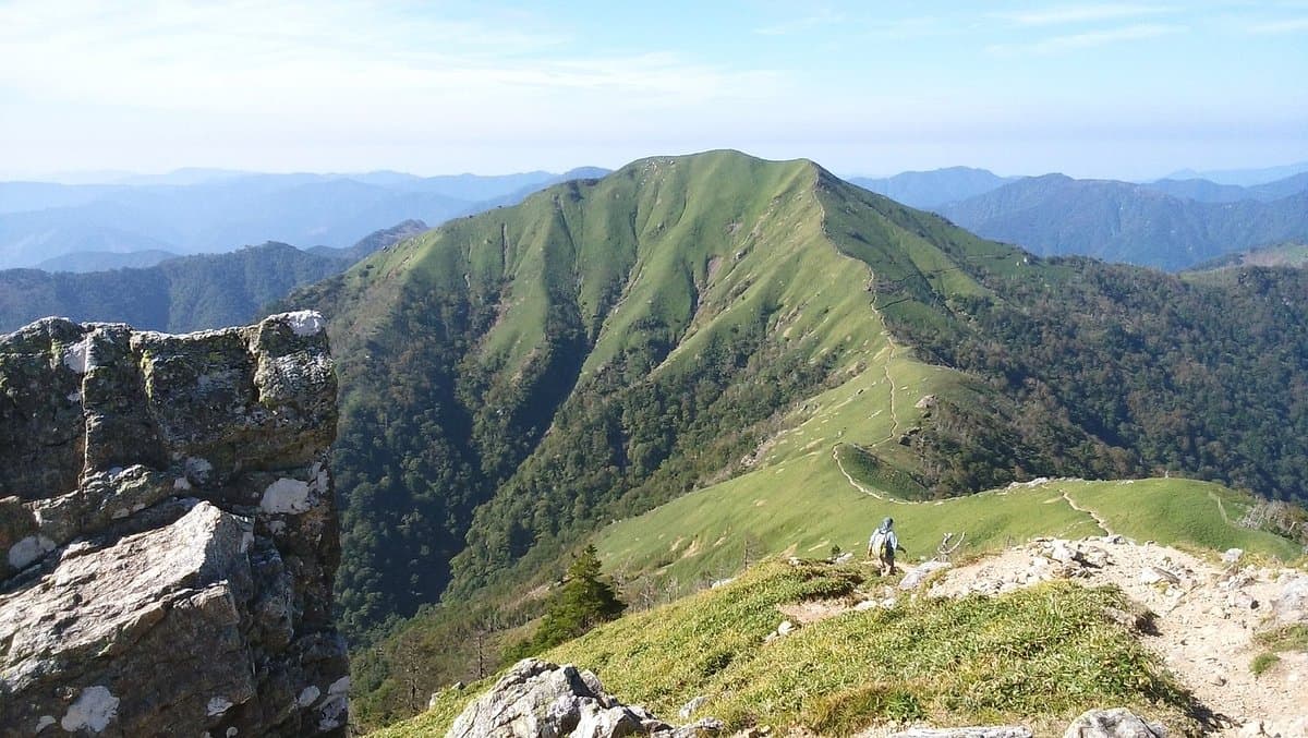
Mt. Tsurugi is the second-highest mountain in Shikoku, standing at 1954.7 meters. It's a significant natural landmark, revered for its natural beauty and offering a relatively accessible mountain experience compared to other high peaks. Its appeal lies in the combination of stunning natural vistas and options that cater to various fitness levels, making it a popular destination for both avid hikers and casual sightseers.
Visitors consistently praise the breathtaking views from the summit, which, on clear days, extend across green valleys and distant landscapes. The availability of a scenic chairlift is a major highlight, allowing many to bypass the steepest sections and enjoy the mountain without an arduous climb. Reviewers note that even non-serious hikers, including teenagers, found the 40-minute hike from the chairlift station to the summit enjoyable. Despite occasional cloud cover obstructing views, many still found the climb worthwhile, appreciating the overall mountain atmosphere and the presence of a temple and pinnacles near the top.
For a comfortable visit, it's advisable to bring tissues, as toilet facilities become less maintained closer to the summit. Consider packing a picnic to enjoy at the summit platforms. The best time to visit is on a clear day to maximize the chances of panoramic views, though even in a drizzle, the experience can be scenic. Allow approximately 1.5 to 2 hours for the hike from the chairlift station to the summit and back, plus time for the chairlift ride and enjoying the views. There are various tracks to choose from, including shorter 40-minute options to the top.
Reaching Mt. Tsurugi involves a significant and often challenging drive. Reviewers describe it as an "epic drive" up twisting, narrow roads with big drop-offs, particularly when coming from the Iya Valley. From Miyoshi (Oboke station), the classic winding drive takes approximately 1 hour 45 minutes to 2 hours 15 minutes, passing through towns like Nagoro (the scarecrow village). Due to the nature of the roads, driving is the primary mode of transport, and visitors should be prepared for a slow and careful journey. Public transport options are limited, making a rental car or organized tour the most practical way to access the mountain.
A common complaint is that views can be obscured by clouds, which is a natural occurrence in mountainous regions. To mitigate this, check weather forecasts before your visit and aim for a day with clear skies. Even with clouds, the journey and the atmosphere of the mountain can still be rewarding, but for the iconic panoramic shots, clear weather is essential.