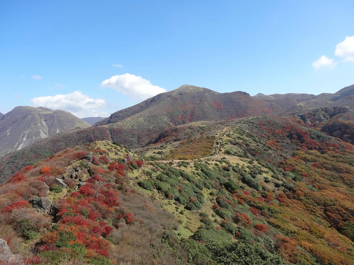
The Makinoto Mountain Path is a significant hiking destination in the Oita Prefecture, renowned for its challenging yet rewarding trails that lead to spectacular panoramic views of the surrounding volcanic landscape. While direct views of Mt. Aso's main crater have been restricted for some time, the paths still offer impressive vistas of smaller volcanoes and the vast caldera, making it a prime spot for experiencing Japan's unique geological beauty.
Visitors consistently praise the well-maintained nature of the paths, despite their steepness. Many highlight the stunning scenery as the primary draw, with the effort of the climb being amply rewarded by the views. Reviewers often mention the free and reasonably sized parking, which makes access convenient for those driving. However, some note confusion regarding which parking areas are designated for climbers versus general tourists. The trails are described as stiff but not excessively long, with each path typically taking 1-1.5 hours to complete.
For a comfortable experience, it is highly recommended to bring hiking poles and wear appropriate footwear, as the steps can be steep. While some visitors have managed short walks in less formal attire, proper hiking gear will significantly enhance safety and enjoyment. The best time to visit is during clear weather to maximize visibility of the distant landscapes. It's advisable to check weather conditions beforehand, as poor visibility due to fog or gas can significantly detract from the experience. There are very few bus services to this area, so driving is often the most practical option.
The Makinoto Mountain Path is located in Kokonoe-machi, Oita Prefecture. Given the limited public transport options, reaching the trailhead by car is highly recommended. The roads leading to the path are generally well-maintained and easy to drive, despite not being very wide in some sections. Ample free parking is available at the trailhead, though visitors might need to clarify which section is best for their intended activity (short walk vs. longer hike).
A common complaint among visitors is the occasional poor visibility due to gas or fog, which can obscure the views. To mitigate this, check local weather forecasts and volcanic activity reports before planning your visit. Arriving on a clear day will ensure the best possible experience of the panoramic vistas.