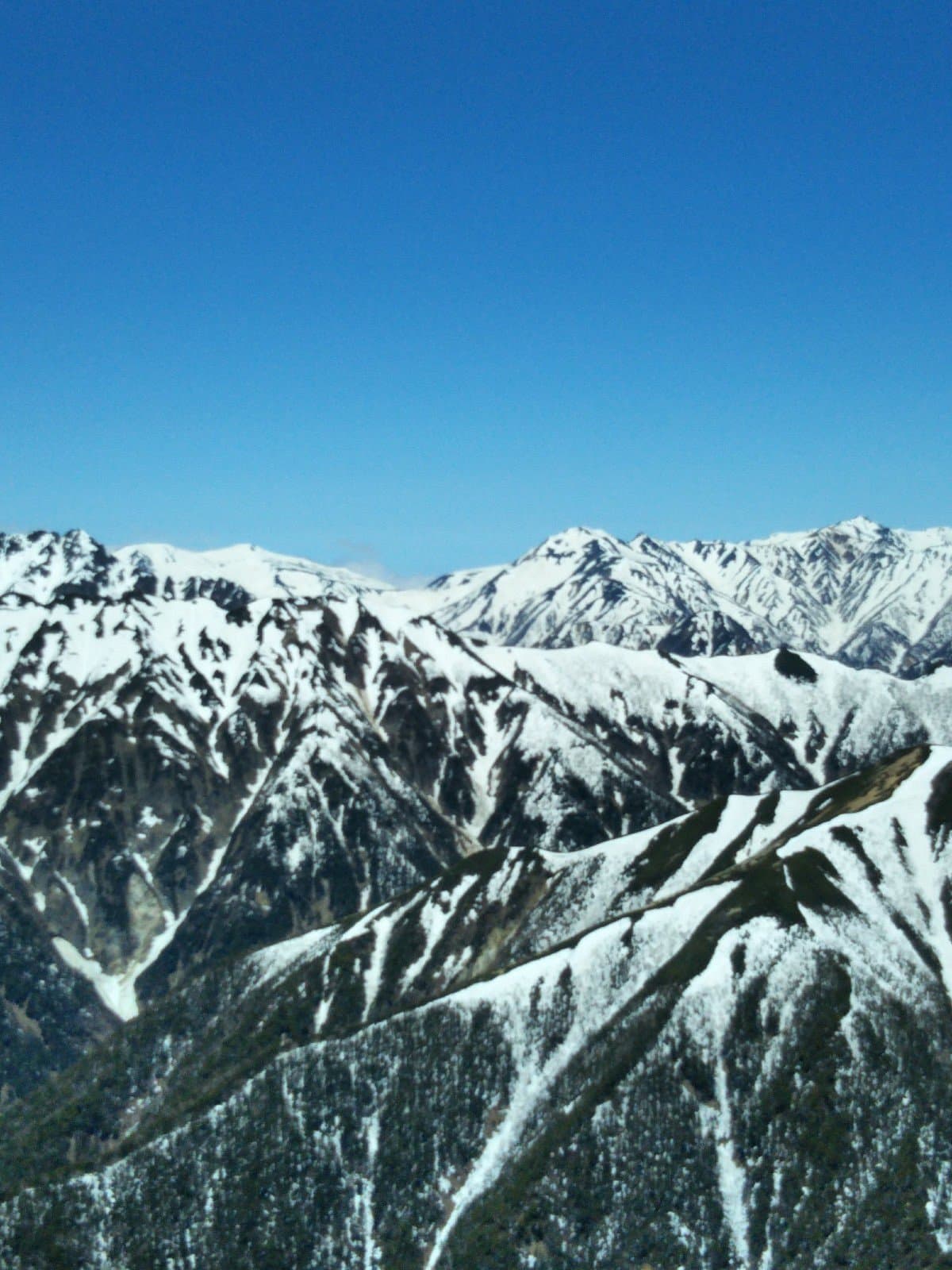
Chōgatake is a prominent peak in the Japanese Alps, renowned among hikers for its challenging trails and the unparalleled panoramic views it offers of the Hotaka mountain range. It stands as a significant destination for those looking to experience the rugged beauty of Japan's alpine regions, providing a demanding yet deeply satisfying outdoor adventure.
Visitors consistently highlight the spectacular vistas from the summit as the primary reward for the strenuous climb. Reviewers describe the panorama of the Hotaka range as "fantastic" and "awesome," making the effort to reach the peak entirely worthwhile. The hike itself is frequently described as "tough" and "hard," indicating that it requires a good level of physical fitness and preparation. Despite the difficulty, the sense of accomplishment and the natural beauty encountered along the way are often cited as major positives.
For those planning a hike, it is advisable to start early, as the ascent can take up to five hours, with the descent being quicker, around two hours. Reviewers suggest bringing downloaded maps, as cell service, while generally good in the park, might be unreliable in certain sections. Given the cold conditions mentioned by some hikers, especially at higher altitudes, appropriate layering and warm clothing are essential, even outside of winter months. It's also wise to carry sufficient water and snacks, as facilities might not be readily available along the trail, particularly if arriving early in the morning.
Access to Chōgatake can be achieved from various starting points. One common approach is from Kamikochi Valley, which is well-served by public transport. Some hikers opt to start from the eastern side of the mountain, taking a taxi from a train station (approximately 40 minutes drive) to the trailhead. For those arriving by overnight bus to Kamikochi, be aware that facilities might not be open in the early morning hours, so plan accordingly for food and amenities. The trail from Yokoo Sanso is another mentioned starting point, indicating multiple route options depending on desired difficulty and duration.
A common complaint, or rather a challenge, is the sheer difficulty and length of the hike. To mitigate this, ensure you are in good physical condition, carry adequate supplies, and allocate a full day for the round trip. Starting early helps avoid crowds and allows ample time to complete the hike before dark. Checking weather forecasts is crucial, as conditions can change rapidly in the mountains, impacting visibility and trail safety.