Mt. Hirugatake is the highest peak in the Tanzawa Mountains, offering a strenuous yet rewarding hiking experience in Kanagawa Prefecture. It is a significant destination for local hikers seeking a challenging ascent and panoramic views, rather than a casual tourist spot.
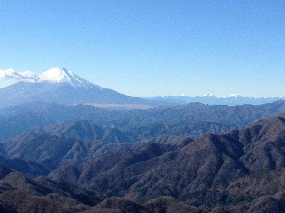
Visitors consistently praise the stunning views from the summit, especially on clear days, which can include Mount Fuji and the Southern Alps. The sense of accomplishment after reaching the peak is a recurring theme in reviews. However, many reviewers emphasize the difficulty of the trails, describing them as steep, long, and requiring good physical condition. Some trails involve chains and ladders, adding to the challenge. The trails are generally well-maintained, but the sheer length and elevation gain are frequently highlighted as demanding.
For a successful hike, it is crucial to bring plenty of water, snacks, and appropriate hiking gear, including sturdy boots, layers of clothing, and rain gear, as weather can change rapidly. A headlamp is also recommended, especially if starting early or finishing late. Most visitors recommend allocating a full day, typically 8-10 hours, for the round trip, depending on the chosen route and fitness level. Starting early in the morning is advisable to avoid crowds and ensure enough daylight. It is not recommended for beginners or those with limited hiking experience.
Access to Mt. Hirugatake typically involves public transportation to the base of the Tanzawa Mountains. Reviewers often mention taking a train to Shibusawa Station (Odakyu Line) and then a bus to the trailhead, such as Okura or Tanzawa-ko. The bus journey can take around 30-45 minutes. From the bus stop, the hike begins, often with a significant walk to the actual ascent point. Parking is available at some trailheads for those driving, but public transport is a common and convenient option for many hikers.
Common complaints revolve around the sheer difficulty and length of the hike, with some visitors underestimating the physical demands. To mitigate this, thoroughly research your chosen route, understand the elevation profile, and honestly assess your fitness level. Avoid attempting this hike in poor weather conditions or if you are not adequately prepared with gear and supplies.