The Ororon Line, officially National Route 232 and parts of National Route 106, is a renowned scenic coastal road stretching along the Sea of Japan in Hokkaido. It's celebrated for its expansive ocean vistas, long straight stretches, and the opportunity to witness the remote beauty of northern Japan. The name 'Ororon' is said to derive from the 'Ororon bird,' another name for the common murre, which inhabits the coastal cliffs.
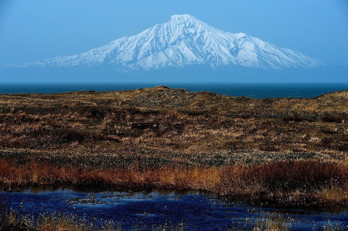
Visitors consistently highlight the road's smooth, straight sections, which make for a comfortable and enjoyable drive, often described as 'addictive' for those who love open roads. The minimal traffic is a recurring positive, allowing for a relaxed pace and uninterrupted appreciation of the scenery. Many reviewers mention the convenience of numerous 'Michi-no-Eki' (roadside stations) located along the route, particularly in towns like Teshio, Enbetsu, Shosanbetsu, Haboro, Tomamae, and Kodaira. These stations provide essential facilities for meals, restrooms, and rest, making the long drive more manageable. The opportunity to spot Mount Rishiri (Rishiri Fuji) in the distance, especially on clear days, is another frequently praised highlight.
For an optimal experience, consider driving from Rumoi north towards Wakkanai, as this direction keeps the coastline and the sea on your left, offering unobstructed views. Allocate at least 3-4 hours for the drive itself, not including stops, to fully appreciate the scenery without rushing. Bringing snacks and drinks is advisable, though roadside stations offer options. While the road is generally flat and straight, some sections can be exposed to strong winds, so a sturdy vehicle is recommended. Cyclists also find the Ororon Line appealing due to its flat terrain and dedicated cycling route information.
The Ororon Line is primarily a driving route, accessible by car or motorcycle. There are no direct public transport options that cover the entire scenic stretch as a tourist experience. Travelers typically rent a car from major cities in Hokkaido like Sapporo or Asahikawa and drive north. The route connects various towns, and local buses might serve segments, but for the full experience, a private vehicle is essential. Parking is readily available at all roadside stations along the route.
While generally praised, some visitors note that cloudy weather can obscure views of distant landmarks like Mount Rishiri, which can be a minor disappointment. To mitigate this, check the weather forecast before embarking on the drive, especially for clear skies, to maximize the chances of seeing the iconic mountain. Also, despite the low traffic, drivers should remain vigilant, as the long straight roads can sometimes lead to unintentional speeding.