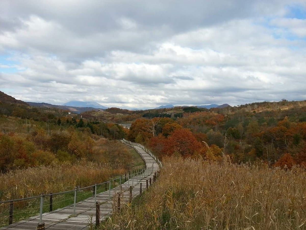
The Nishiyama Sanroku Kako Walking Path is not just a trail; it's an open-air museum preserving the immediate aftermath of the 2000 eruption of Mount Usu. This site is crucial for understanding the geological history of the Lake Toya region, offering a raw and educational experience of volcanic impact. Unlike traditional museums, here the exhibits are the actual roads, buildings, and landscapes warped and destroyed by the eruption, left as they were when residents evacuated.
Visitors consistently praise the unique and poignant nature of the preserved ruins, particularly highlighting the 'slanted kindergarten' as a memorable and impactful sight. Many find the experience both educational and thought-provoking, appreciating the opportunity to witness the power of nature firsthand. Reviewers often describe it as a 'long walk but so worth it' for the insights it provides into the area's history and geology. However, some visitors warn about the physical demands, noting numerous stairs and potentially slippery paths, especially after rain.
To make the most of your visit, allocate at least 90 minutes to two hours for the walk, especially if you plan to explore thoroughly. Wear comfortable walking shoes with good grip, as paths can be uneven and slick. It's advisable to visit on a dry day to avoid slippery conditions. While there's a shop at the start, some reviewers found the ice cream underwhelming, so consider bringing your own snacks and water. Check for seasonal closures, as trails might be inaccessible in early spring due to snow, even if visibly clear.
The trail starts near the Toyako Visitor Centre, which is a short walk from the Bus Terminal. Maps of the Nishiyama trail are available at the Tourist Information Centre at the Bus Terminal. For those using public transport, taking a bus to the area is convenient. If driving, parking is available near the Visitor Centre. Be aware that taking a 'wrong path' at the bus stop can lead to other trails, so consult the map carefully.
A common complaint is the physical exertion required, particularly the many stairs on the return journey. To mitigate this, ensure you are reasonably fit and allow ample time, taking breaks as needed. Some visitors also express disappointment if trails are closed due to snow, even when conditions appear clear; it's best to check the official opening status before planning your trip, especially in early spring.