Mt. Tenpaizan is a modest but significant peak located near Chikushino, Fukuoka Prefecture, often visited in conjunction with the historical sites of Dazaifu. It's valued by locals for its accessible trails and the rewarding views from its summit, offering a natural escape from urban life.
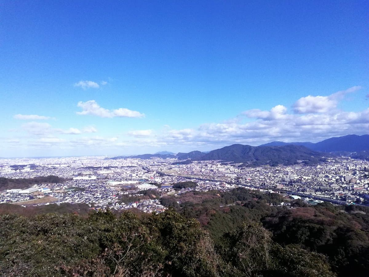
Visitors consistently praise the ease and accessibility of the hike. Reviewers highlight that the trails are very well maintained, making it suitable for hikers of all levels, including families. The relatively short ascent, often taking only 30-40 minutes to reach the summit, is a recurring positive point. The panoramic views from the top are frequently mentioned as a significant reward for the effort, providing a scenic outlook over the region. Some visitors combine the hike with a visit to Dazaifu and the Kyushu National Museum, finding it a pleasant way to add outdoor activity to their cultural itinerary.
For a comfortable hike, wear appropriate walking shoes, even though the path is well-maintained. A small bottle of water is advisable, especially on warmer days. Most visitors suggest allocating about 1 to 2 hours for the round trip, including time to enjoy the views at the summit. The best time to visit is during pleasant weather, avoiding the peak heat of summer or heavy rain. There are toilets available in the Tenpaizan Historical Nature Park, near the lake and further into the park, which is a useful amenity for hikers.
To reach Mt. Tenpaizan, search for 'Tenpaizan Historical Natural Park' on Google Maps, which marks the trailhead. The nearest train stations are JR Futsukaichi Station or Murasaki Station, depending on your train line. From JR Futsukaichi Station, the trailhead is approximately a 15-minute walk. Public transport is a viable option for access, and the park is well-signposted once you are in the vicinity.
Common complaints are minimal, primarily related to the mountain's modest height, meaning it might not satisfy experienced hikers looking for a challenging ascent. However, for those seeking a quick, scenic, and accessible outdoor activity, these are not significant drawbacks. The main mitigation is to go with appropriate expectations for a short, pleasant walk rather than an arduous climb.